NavShip december update
During the winter season we can change things in the app that we hardly find time to do in the summer due to the high support volume.
We received a lot of user feedback in 2023 and were able to implement some of it. The app is now fully available in America and units can be changed from metric to imperial.

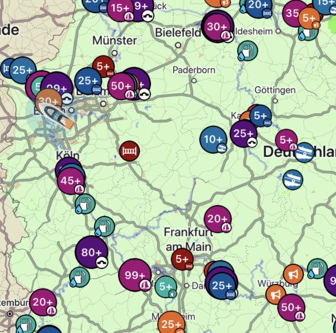
The biggest innovation starts with the next iOS update, which we will make available on December 6th, 2023. Android is expected on December 8th. All markers are now displayed by default throughout the entire driving area. Since these are a lot of markers, they are grouped together according to their type.
This makes it directly visible where bridges, barriers, locks, etc. are located. Of course, you can also return to the classic view (displaying the symbols only on the calculated route); this can be configured in the settings in the side menu.
We have also adjusted our symbols slightly. A megaphone is now displayed for NfB warnings and a barrier for NfB closures.
During our revision, we also included a lot of new sailing areas, e.g. the Caribbean, and reworked some overseas areas (Cape Verde, Azores, etc.). A total of over 9,900 new ports, bridges and berths were integrated, which can also be accessed directly using the search.


0 Comments