NavShip Anniversary Year – A brief app time travel

On July 17, 2026, the time will have come – NavShip will turn 10 years old. During this time, both the app and the website have undergone significant changes. In some cases, there have been huge leaps forward in just a few months of development.
2016 – An Unexpected Journey
Born out of necessity—the need for reliable route planning for the major waterways in Central Germany for an upcoming trip (from Frankfurt/Main to Lahnstein)—the NavShip app launched on the Google Play Store on July 17, 2016, embarking on a journey whose course was, at the time, unpredictable. Its design was simple. Only the Rhine, Main, and Lahn rivers were available. Information on water levels, marinas, and moorings was virtually nonexistent. Only locks with their call and radio channel numbers, as well as clearance heights, were included.
At that point, the app’s development time had been a mere few weeks. To explain how the idea even came about, a brief account from my subjective perspective is necessary:
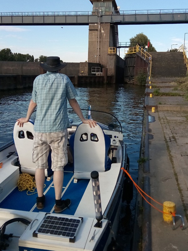
Back in August 2015, after completing my self-built boat (see the post here) and taking it for a test run on the Main River, I started planning to use an app to navigate the Main and Rhine downstream. However, my Android device at the time was underpowered. The apps available on the market didn’t seem to offer the features I needed, or they didn’t even provide a route. So, I simply drew the route on a printed map (A4 size) and wrote down the phone numbers for the locks from the ELWIS (Electronic Waterways Information System). Just in case. And indeed, an emergency did occur. At dusk, under the Schierstein Bridge in Wiesbaden, the engine (built in 1970) suddenly died. After a friendly sailor towed us under motor to the harbor, and then the water police pulled us to the slipway, the trip was over – at least for that year.
I simply drew the route on a printed map (A4 size) and retrieved the phone numbers for the locks from the ELWIS (Electronic Waterways Information System) and wrote them down.
Second Attempt
The following year, I wanted to set sail again—this time with a new, more reliable engine (built in 1996) and more information about the route (travel time, distance I could cover each day, etc.). The NavShip app version 1.0, available in the Play Store, and a discussion in Boote-Forum got the ball rolling. I put my planned trip in August 2016 on hold and instead focused on developing the app.
Due to the numerous requests (“could you please add this or that river?”) and the strong interest in additional features, there was little time for vacations for several months. Trips were mostly limited to day trips, during which the app was almost exclusively tested.
Back then, the app certainly didn’t win any beauty contests. The design was very pragmatic, and the focus was on developing new features and collecting data.
2017 to 2019 – Years of Growth
NavShip didn’t have many users in the beginning. The support email address received perhaps one or two emails a day, mostly requesting new features. These were usually implemented quickly. It wasn’t until June 2017, almost a year after the Android version was released, that NavShip made its way to the Apple App Store. The reason at the time was that Apple equipment was quite expensive compared to Android.
Monetization of NavShip through the sale of premium memberships had already begun for Android in April 2017. It then took several more months to recoup the costs for the Mac version—which is unfortunately necessary for iOS development. Monetization of the iOS version then started in January 2018. At that time, the NavShip app still included advertising to finance the free version. In case you haven’t noticed: In versions since December 2025, we have completely stopped showing external advertising and only display our internal advertising.
Back to 2017 – The App’s Development
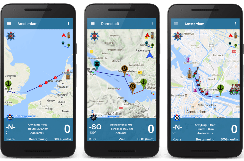
In the early days, most inquiries concerned inland waterways. The Netherlands, as well as the Havel and Müritz lakes, were the most popular destinations for a long time. The Croatian cruising area was frequently requested, but it failed to gain traction in the years leading up to 2020 due to the lack of optimal, straight-line routing. Routes were predominantly routed along the coast.
With improvements to the algorithms and increased device performance, coastal routing was finally integrated into the app in 2020.
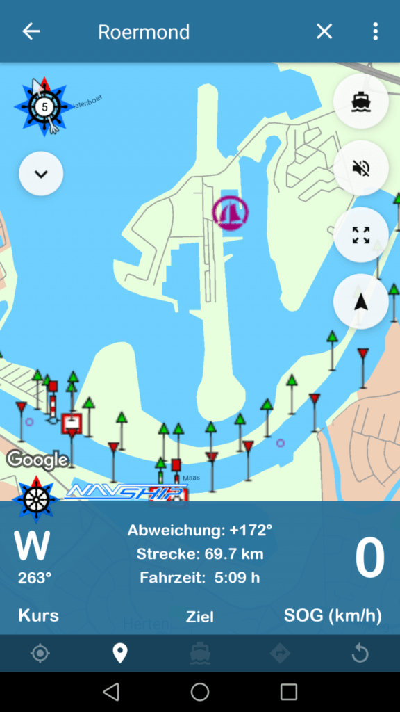
Other features added for the first time in 2017 included anchor alarms, water levels, wind and weather data, berths and anchorages, slipways, and fuel stations.
AIS support was added in 2018. Initial reports about NavShip appeared in print media and online (e.g., in Float magazine), followed in 2019 by voice guidance and a major data overhaul.
2020 – And then came Corona…
Until January 2020, I was working as an employed software developer in a small development studio near Darmstadt. I had found a position there immediately after completing my Master’s degree in December 2017. For my next career move, I switched to another company in February 2020. Due to the lockdown in March, and because I, as the newest employee, would have been the first to be affected by reduced working hours, which didn’t fit with my lifestyle, I submitted my resignation immediately. NavShip’s revenues were sufficient last year to keep me afloat for another year. Therefore, I quickly commissioned a notary to establish CproSoft GmbH. Due to the lockdown, it wasn’t easy to even find one willing to handle the incorporation. In May 2020, the time had finally come:
All or nothing – in this case: All in on the app!
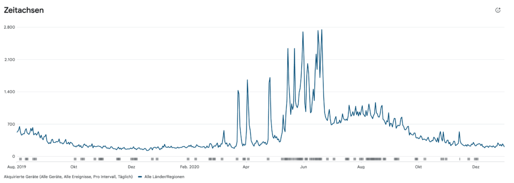
In August 2019, we had approximately 500-700 installations per day (and only 100-200 in December 2019). By April 2020, this number had already risen to 1,500, and by June to almost 2,800. We hadn’t anticipated such a sudden 300% increase. We quickly set up a new server. I immediately hired two employees to help me with customer support and development. Managing staff and double-entry bookkeeping were new territory for me at the time, as was running a real company with all the associated responsibilities.
2021 to 2025 – Onward to New Horizons
NavShip gradually became more and more well-known. A key player when it comes to route planning on the water. The risk of investing 100% in self-employment paid off in the very first year. In comparative tests (e.g., in the boating magazine), NavShip consistently ranked among the top performers. Our 2023 sailing feature, which improves the visualization of wind data and displays sailable areas, now opens the app to a wider user base. On April 13, 2024, we surpassed the milestone of one million users. Currently (as of March 22, 2026), we have approximately 1.3 million users.
In the meantime, we were able to hire another employee for support and data entry, as well as a marketing employee.
After years of focusing on functionality, we finally had enough time to update the app in terms of usability and design.
Admittedly, design isn’t my favorite thing. I much prefer working with algorithms and the deep codebase. But the result is still impressive.
In addition, we’ve launched other apps over the past few years. These include the boat routing app, which complements the web version, and the waterway information system. These apps are also available in the app stores.
The web version, boatrouting.com, is enjoying increasing popularity and offers up to five calculations per day free of charge (unlimited for premium members). We have also been able to integrate additional data sources.
2026 – Where the Journey Will Lead
AI is on everyone’s lips. We are deliberately bringing this up here because our business is constantly offering opportunities for collaboration based on AI. However, we remain reluctant to use AI beyond image generation and text support (this article, by the way, contains neither AI-generated images nor AI-generated text). At NavShip, people work – and that’s how it will stay. We plan to hire another person for customer support and data collection by mid-2026.
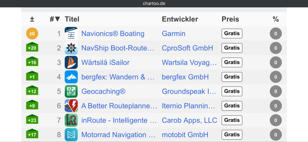
App Comparison
Source: chartoo.de, January 26, 2026
As a global player, we consistently hold our own against the competition and are always among the top performers. Our customers particularly praise our excellent support, ease of use, and the speed of our route calculations. We will continue to maintain these standards.
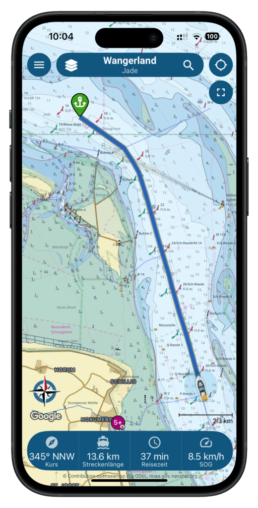
With freenauticalchart.net, we’re now also integrating depth data for the German and Dutch coasts. We consider this project highly worthy of support. Our newest feature, introduced in March 2026, is the new route management system. To answer the question “where are we headed?”, we’re definitely moving towards networking and community building. Sharing, liking, and commenting on routes with each other is the first step towards social boating. We will closely analyze its progress and introduce further features in this direction. Your data is safe with us! A route will not be published unless you explicitly grant permission – for each route individually.
We look forward to another ten fantastic years with you and would like to extend our sincere thanks to the entire community.
Chris and the NavShip Team


0 Comments